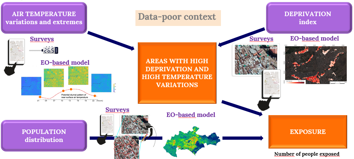
Methodology
We develop 3 modelling workflows and will combine the outputs of our models into fine-grained gridded maps
to stimulate the debate about the use of local building materials and urban designs to better adapt to climate change impacts, and to support planning processes
for protecting inhabitants with limited resources against the increasing climate change impacts.
TEMPERATURE
We will statistically quantify the spatiotemporal variations of near-surface air temperature using a set of covariates,
and investigate whether low-cost measurements by citizens can replace or reduce fixed (high-cost) measurement stations, which would support the transferability and scalability of the methods.
DEPRIVATION
We will model a deprivation index in great spatial detail within DUAs using AI models, with micro-surveys, EO data, and open geospatial data,
the main challenges being the sparsity of training data and the development of models that output fine-grained predictions while being scalable and transferable.
POPULATION
We will model population distribution within DUAs harnessing the power of multi-modal deep learning, EO and ancillary data
such as publicly available building footprint datasets.